| نسخه | ۳.۴۶ |
| آخرین بروزرسانی | ۱۴۰۵/۰۲/۳۰ |
| تعداد دانلود | ۲۰۰ |
| حجم | ۱۱ مگابایت |
| نوع | برنامه اندرویدی |
| دستهبندی | ابزارهای کاربردی |
| سازنده | Disciple Skies Software |
Land Calculator: Map Measure
آیا تابهحال برنامه Land Calculator: Map Measure را امتحان کردهاید؟ این برنامه با امکانات کاربردی و ویژگیهایی خاص، تجربهای متفاوت را برای شما رقم میزند.
دانلود برنامه Land Calculator: Map Measure
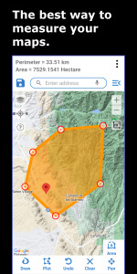
Land Calculator یک برنامه قدرتمند و در عین حال کاربردی آسان برای اندازه گیری مساحت و محیط برای هر مکانی است.
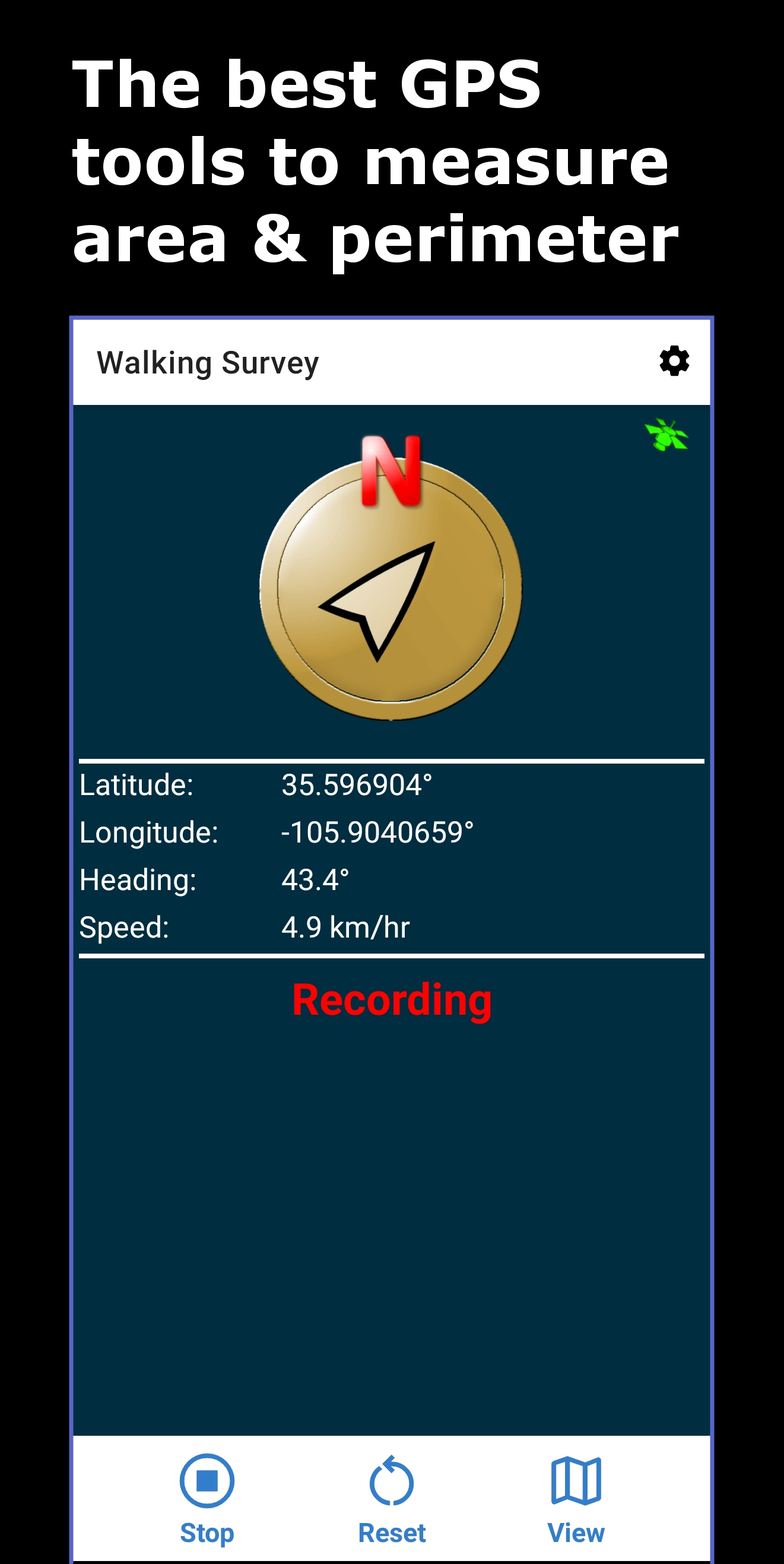
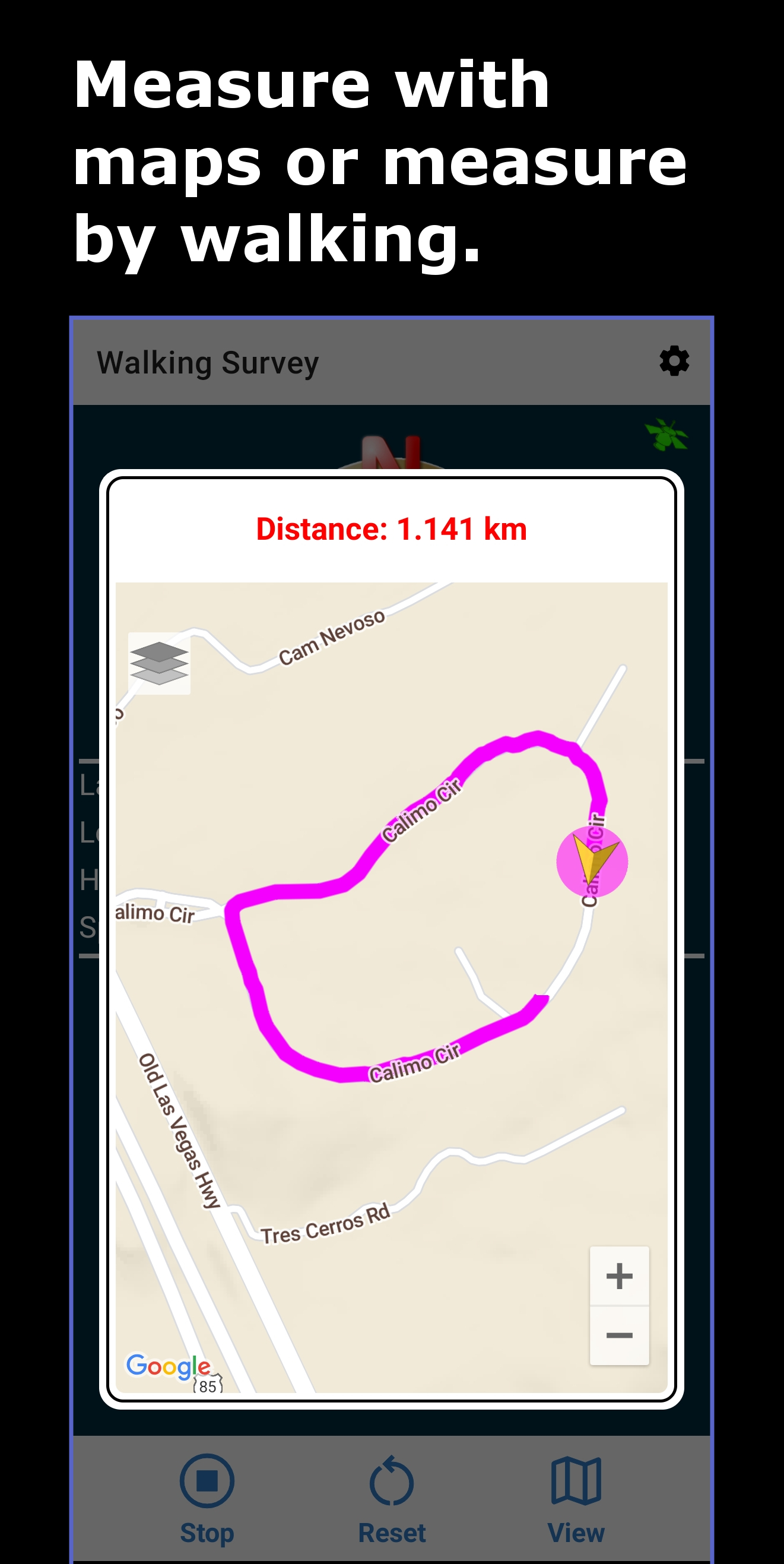
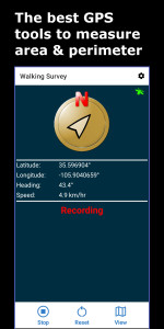
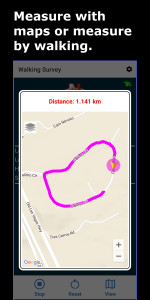
محیط و مساحت هر منطقه را بر روی نقشه اندازه گیری کنید یا از GPS دستگاه خود برای بدست آوردن مساحت، محیط و طول مسیر مکانی که پیاده روی یا رانندگی می کنید استفاده کنید.
متداولترین کارهایی که این برنامه انجام میشود عبارتند از:
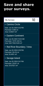
⚖ با رسم هر شکلی روی نقشه، یک بررسی میدانی ایجاد کنید تا ناحیه و محیط محصور آن را بدست آورید. نقاط و منحنی ها را ترکیب کنید تا بهترین نقشه ممکن را انجام دهید. پشتیبانی از هر شکلی که می توانید بکشید!
⚖ با پیاده روی یا رانندگی در محیط آن، مساحت زمین و محیط را برای هر میدان شکلی دریافت کنید.
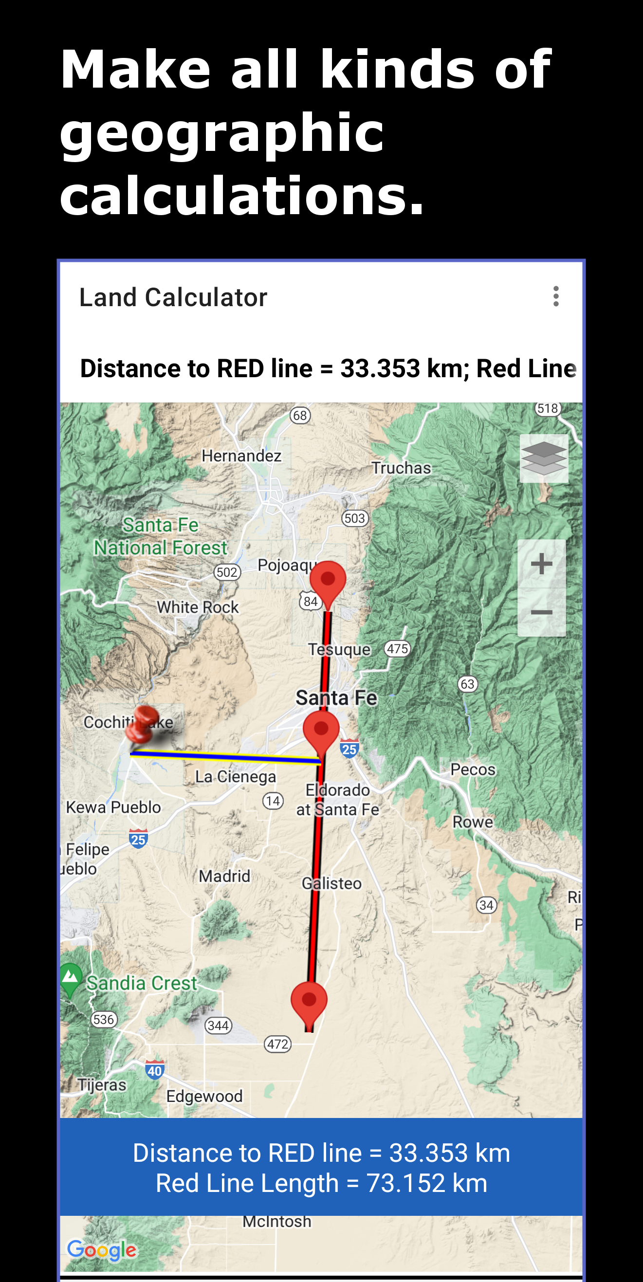
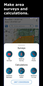
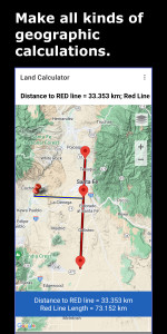
⚖ فواصل نقطه به نقطه را با ابزارهای مختلف نقشه و ابزارهای بررسی اندازه گیری کنید.
📏 ابزار تبدیل واحد مساحت و محیط.
⚖ کوتاهترین فاصله تا یک خط با ژئودزیک اتصال دقیق.
این برنامه شامل:
● انتخاب سیستم های مختصات از جمله: WGS 84، بررسی مهمات بریتانیا (OSG36 Datum)، ANS، NAD 27، ED 50، NAD 83 و چندین مورد دیگر.
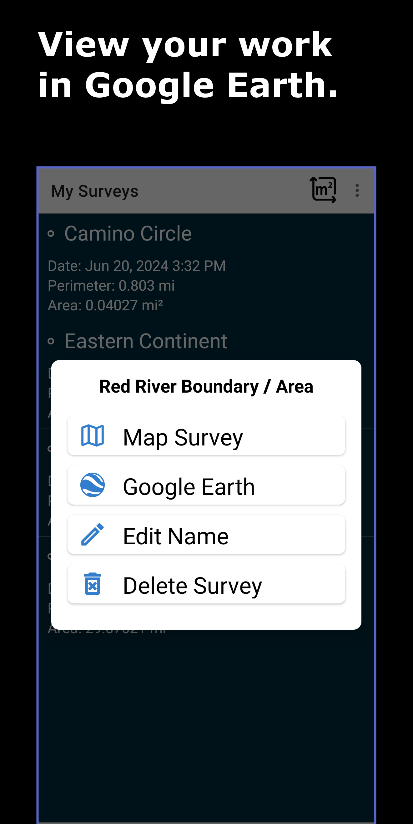
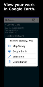
● یک ویژگی پشتیبانگیری و بازیابی: کار خود را با استفاده از ویژگیهای پشتیبانگیری و وارد کردن kml برنامه، ایمن و بازیابی کنید. نظرسنجی ها را با همکارانی که ممکن است کار شما را در Google Earth روی رایانه رومیزی یا تلفن خود یا در Land Calculator مشاهده کنند، به اشتراک بگذارید. گوشی جدیدی دارید و تمام کارهایتان روی گوشی قدیمی است؟ مشکلی نیست! تمام کارهای قدیمی خود را با فرآیند بازیابی یک کلیک برنامه به تلفن جدید خود وارد کنید.
● از داده های تولید شده توسط این برنامه در ArcGIS با تبدیل فایل های KML برنامه با ویژگی KML2Layer ArcGIS استفاده کنید، یا از ابزار KML برای تبدیل فایل های KML برنامه به DXF (فرمت تبادل طراحی) برای استفاده در طراحی استفاده کنید. برنامه هایی مانند AutoCad و SketchUp.
قطب نما با کنترل GPS و گزارش GPS برای کمک به بررسی های میدانی شما گنجانده شده است.
چه کسی از این برنامه استفاده میکند؟
● کشاورزان برای محاسبه نیازهای تجهیزات، نیاز بذر، تخمین مصرف آب، تخمین مقدار برداشت و ارزش محصول از آن استفاده میکنند.
● توسط نمایندگان املاک برای اندازهگیری اندازه ملک استفاده میشود.
● نمایندگان بیمه از این برنامه برای اندازهگیری اندازه ملک برای اهداف تعدیل استفاده میکنند.
● بازرسان املاک از برنامه برای دریافت اندازه گیری اموال مورد استفاده در محاسبات وام مسکن استفاده می کنند.
● توسط مشاغل بهسازی زمین برای برآورد نیازهای تامین حصار و سایر تجهیزات ساخت و ساز استفاده می شود.
اگر نیاز به انجام یک نوع محاسبه بسیار تخصصی دارید و ابزارهای آن را در برنامه نمی بینید، با ما تماس بگیرید:
support@discipleskies.com
br>و ما توسعه و افزودن ابزار تخصصی مورد نیاز شما را در نظر خواهیم گرفت.
تغییرات برنامه Land Calculator: Map Measure در نسخه جدید