
| نسخه | ۲۰۲۶.۲.۰ |
| آخرین بروزرسانی | ۱۴۰۴/۱۱/۲۲ |
| تعداد دانلود | کمتر از ۱۰۰ |
| حجم | ۶۱ مگابایت |
| نوع | برنامه اندرویدی |
| دستهبندی | ورزشی |
| سازنده | Trailforks |


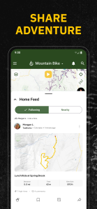

Trailforks
آیا تابهحال برنامه Trailforks را امتحان کردهاید؟ این برنامه با امکانات کاربردی و ویژگیهایی خاص، تجربهای متفاوت را برای شما رقم میزند.
دانلود برنامه Trailforks
دوچرخه سواری نهایی را با Trailforks برنامه ریزی کنید. بهترین برنامههای دوچرخهسواری را با ابزارهایی کاوش کنید که به شما کمک میکند از دوچرخهسواری در کوهستان، دوچرخهسواری موتوری، دوچرخهسواری چربی، دویدن در مسیر و غیره استفاده کنید. Trailforks بهترین ناوبر بک کانتری است که برای همه ماجراجویی های خارج از جاده شما ساخته شده است. یک ردیاب دوچرخه برتر دریافت کنید که دقیقترین نقشههای مسیر، GPS مفید دوچرخه، گزارشهای وضعیت، و ابزارهای برنامهریزی مسیر را ارائه میکند - همه در Trailforks.
ویدئو معرفی برنامه
بیشترین تعداد مسیرها را درست در جیب خود داشته باشید. 670000+ مسیر را کاوش کنید، که برای ماجراجویی دوچرخهسواری بعدی، آموزش دوچرخهسواری، و همه چیز در این بین عالی است. ردیاب دوچرخه سواری ما پر از آمار و اطلاعات دقیق و به روز برای همه سواری های شما است. همین امروز دانلود کنید و شروع کنید.
ویژگی های TRAILFORKS
بهترین برنامه های دوچرخه سواری
- برنامه دوچرخه سواری با بزرگترین پایگاه داده مسیرهای پیاده روی جهان
- گزینه های دوچرخه سواری برای هر فعالیتی – دوچرخه سواری چربی ، cyclocross، دوچرخه سواری خاکی و موارد دیگر
- GPS دوچرخه سواری با سازگاری GPX. دستگاه Garmin یا Wahoo خود را همگامسازی کنید
- با دانلود نقشههای دوچرخهسواری رایگان ما، دوچرخهسواری بعدی خود را در هر مکانی انجام دهید
- ردیاب دوچرخهسواری ما به شما امکان میدهد مسیرهای محلی خود را ایجاد کنید
- مشاهده مسیر دوچرخه و اطلاعات منطقه با 1 میلیون عکس، ویدیو، و گزارش مسیرهای 3M
- برنامه دوچرخه سواری رایگان با لینکها و مسیرهای سریع به دوچرخهفروشیهای اطراف
- دوچرخهسواری در مسیرهای پشتیبانی با خیال راحت
- یک ردیاب دوچرخه با اطلاعات مسیر و میانگین زمان تکمیل دریافت کنید
پشتیبانی چند فعالیت
- Fatbike، دوچرخه سواری و موارد دیگر!
- بیش از یک برنامه دوچرخه سواری - مسیرهایی را برای پیاده روی، دویدن در مسیر، اسکی و موارد دیگر پیدا کنید.
- رایگان نقشههایی با هزاران نقطه مورد علاقه فعالیت مرتبط (POI).
- نقشههای توپو متعلق به شما هستند تا به شما کمک کنند با ماجراجویی در فضای باز بعدی خود مقابله کنید
- نقشههای پیادهروی: مسیرها و مسیرها را کشف، برنامهریزی و کاوش کنید
GPS NAVIGATION
- ویژگی های GPS دوچرخه Trailforks را به ابزار ناوبری کامل تبدیل می کند
- ردیاب دوچرخه سواری، ردیاب دویدن و موارد دیگر - همه در یک
- نقشه های جاده را در جهتی که روبه رو هستید جهت دهید
>نقشه های توپوگرافیک برای اطلاعات کلیدی
- نقشه ها و اطلاعات توپو آفلاین را با به روز رسانی های سریع و تدریجی منطقه دریافت کنید
- دوچرخه سواری با نمایه های ارتفاع مسیر که در برنامه نمایش داده می شود
- نقشه های رایگان را با فهرست رو به رشد مسیرها کاوش کنید< br>- لایههای نقشه حرفهای مانند زاویه شیب، آلودگی نوری، USFS، مالکیت زمین، دادههای بهمن و موارد دیگر را تغییر دهید!
- بهترین برنامههای دوچرخه را با ایجاد مسیر به سمت مسیر دلخواه خود دریافت کنید
- زمانی که بازی در فضای باز خود را ارتقا دهید مشاهده بخشهای Strava
- پوشش مالکان زمین در ایالات متحده مانند BLM
- مشاهده چند ضلعی برای داراییهای خصوصی یا مناطق بسته
رویدادهای مسیر، وضعیتها و هشدارها
- مسیرهای دوچرخهسواری را در فهرست خواستههای خود ذخیره کنید< br>- رویدادهای نزدیک یا بر اساس منطقه را مشاهده کنید
- مکان نقشه خود را با دوستان و خدمات اضطراری به اشتراک بگذارید
- ردیاب دوچرخه سواری شرایط مسیر و بسته شدن آن را کنترل می کند
- گزارش های مسیر را ارسال کنید، از جمله عکس هایی از مشکلات مسیر
- هر دوچرخه سواری را ضبط کنید و نشان های مسیر محلی را به دست آورید
- همگام سازی کنید و 'طرح های مسیر' ذخیره شده را از وب به برنامه مشاهده کنید
سواری خود را با TRAILFORKS PRO با خارج از+ ارتقا دهید
- باز کردن قفل دسترسی به نقشه سراسری، از جمله نقشههای پایه Garmin
- همگامسازی اولویتدار با دستگاه Garmin یا Strava شما
- از نقاط بین راه و فهرستهای خواستهها لذت ببرید
- دسترسی به ابزارهای دوچرخهسواری دسکتاپ به برنامه مانند printmap و فایلهای GPX و KML قابل دانلود
- دسترسی نامحدود به برنامه پیادهروی و آفرود Gaia GPS
- دورههای آنلاین تحت رهبری متخصصان در خارج از کشور
- دسترسی ممتاز به فیلمها، نمایشها و تلویزیون زنده برنده جایزه در Outside Watch
- دسترسی دیجیتال نامحدود به Outside Network 15 برند نمادین از جمله Outside Online، Velo، و Pinkbike
Trailforks برنامه دوچرخه سواری رایگان کامل برای ماجراجویی های شما در فضای باز است. با بهترین ردیاب دوچرخه برای سواری بعدی خود به فصل جدید خوش آمدید - Trailforks!
نقشه های دقیق مسیر برای مقاصد معروف دوچرخه سواری کوهستان مانند، ویستلر، اسکوامیش، ساحل شمالی، کاملوپس، نلسون، موآب، سدونا، پارک سیتی ، طوفان، داونی ویل، کلرادو اسپرینگز، بلینگهام، بنتونویل، فینال لیگور، پیسگاه، مارین، بند اورگان، ولینگتون و روتوروا نیوزلند.
تغییرات برنامه Trailforks در نسخه جدید


