| نسخه | ۱۲.۰ |
| آخرین بروزرسانی | ۱۴۰۵/۰۱/۲۸ |
| تعداد دانلود | کمتر از ۱۰۰ |
| حجم | ۸۸ مگابایت |
| نوع | برنامه اندرویدی |
| دستهبندی | سیر و سفر |
| سازنده | Surfcheck |

Water Map Live - Routes, AIS
آیا تابهحال برنامه Water Map Live - Routes, AIS را امتحان کردهاید؟ این برنامه با امکانات کاربردی و ویژگیهایی خاص، تجربهای متفاوت را برای شما رقم میزند.
دانلود برنامه Water Map Live - Routes, AIS
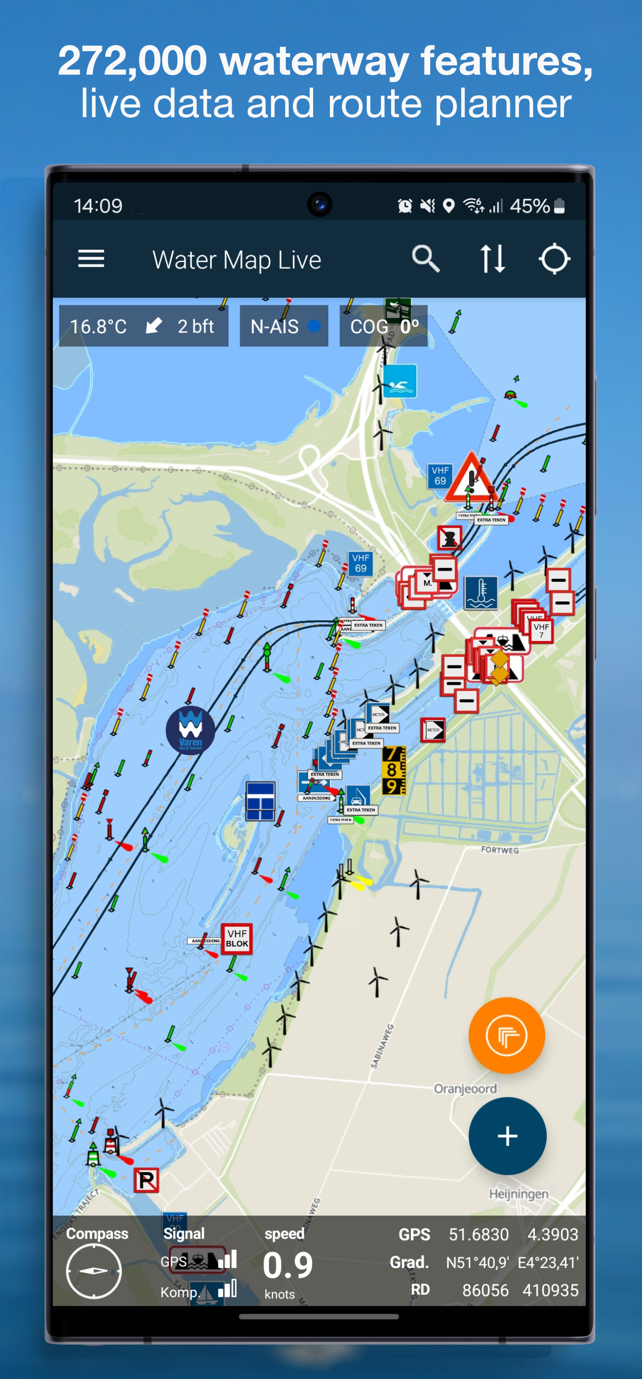
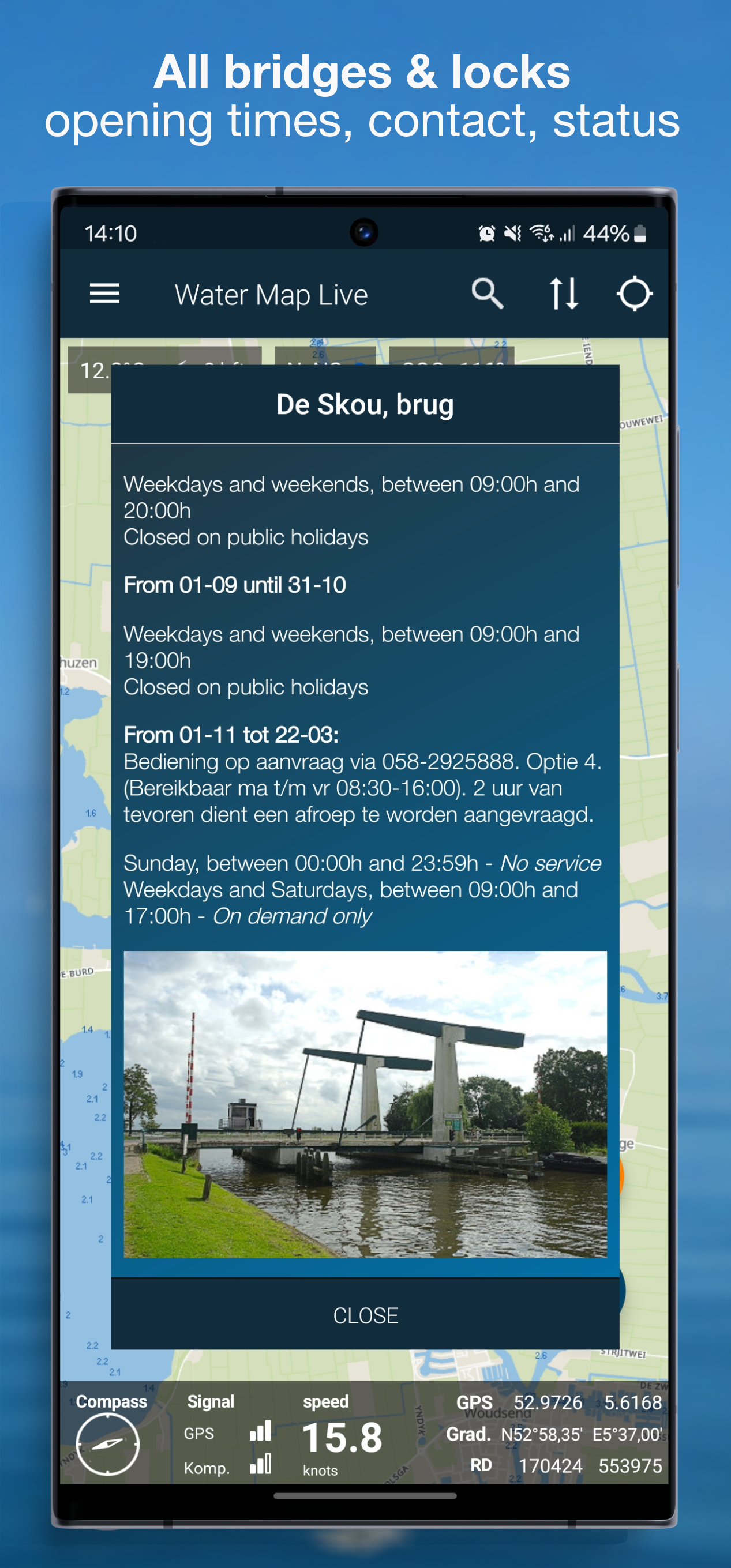
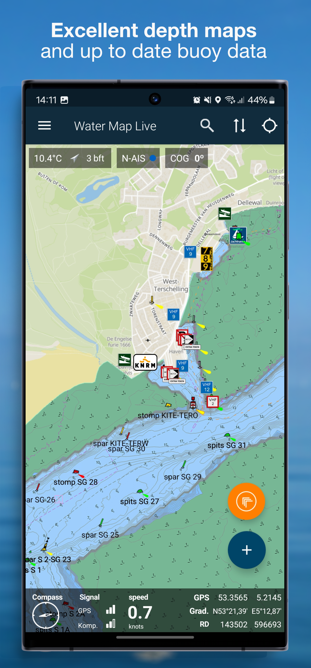
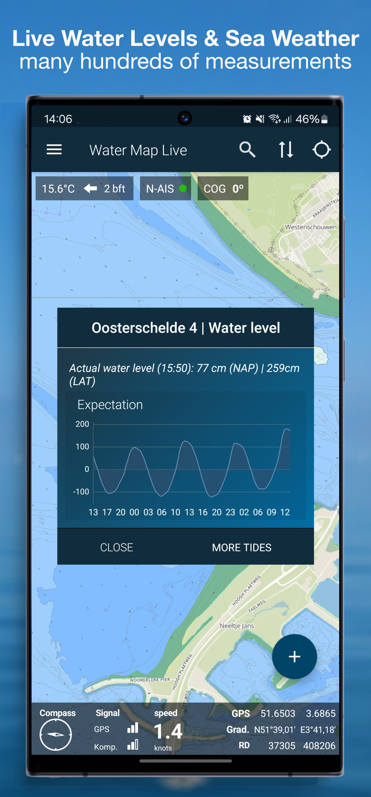
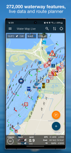
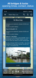
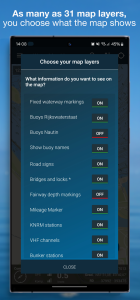
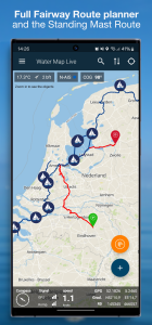
این تا کنون کامل ترین نمودار آبراه و قایق رانی هلند، بلژیک و آلمان است. با تمام ویژگیهای راه آهن، شناورها، علائم راهنمایی و رانندگی و پلها و قفلهای *زنده*: زمان بازگشایی، شماره تلفن و کانالهای رادیویی VHF. بیش از 272000 شی در نقشه، به راحتی در لایه های نقشه مرتب شده اند که می توانید به دلخواه روشن و خاموش کنید.
همه نمودارهای آب را می توان دانلود کرد و به صورت آفلاین استفاده کرد.
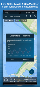
این برنامه واقعاً زنده است و شامل صدها سطح آب فعلی، منحنی های جزر و مدی، آب و هوا در دریا و منطقه شما، اعماق آب، داده های ایستگاه های KNRM و کیفیت آب مکان های حمام هلندی بی شمار است. و اخطارهای فعلی به کاپیتانان (NtS): آیا موانعی در مسیر شما وجود دارد؟ الان میدونی همیشه بهروز است.
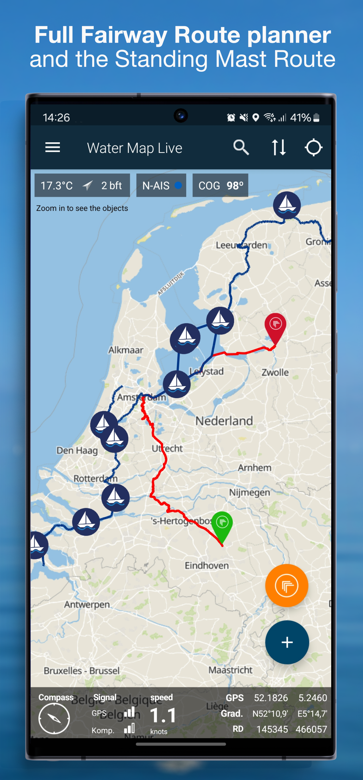
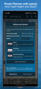
در مجموع، این برنامه حاوی دادههای بیش از صد هزار شیء دریایی است که روی نقشه اطراف شما نشان داده شدهاند. به لطف GPS شما همچنین می توانید سرعت و مختصات فعلی خود را بخوانید. با ردیاب جیپیاس میتوانید مسیرهای خود را ضبط و ذخیره کنید.
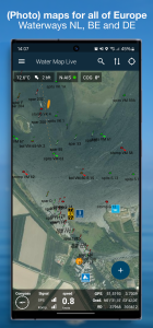
این برنامه بر اساس مواد نقشه از ثبت زمین هلند است و همچنین شامل نقشههای توپوگرافی زیبای 1:25000 هلند است.
Water Map Live برای استفاده آفلاین عالی است، اما اطلاعات زنده در مورد پل ها و قفل ها، NtS، سطح آب فعلی و آب و هوای فعلی به طور طبیعی از اتصال اینترنت استفاده می کند.
شرایط.
ما نهایت تلاش خود را می کنیم تا یک برنامه نقشه آب فوق العاده و دقیق ارائه می دهد، اما مطمئناً نمی توانیم تضمین کنیم که نرم افزار و داده های ارائه شده در آن همیشه کار می کنند و 100٪ درست هستند. منابع داده گاهی اوقات می توانند تغییر کنند و شما نمی توانید هیچ حقوقی را از این برنامه یا اطلاعات ارائه شده در آن دریافت کنید. البته استفاده به عهده شماست. با دانلود و استفاده از این برنامه نقشه آب، این شرایط و ضوابط را می پذیرید.
موقعیت مکانی
مجوز موقعیت مکانی فقط برای نشان دادن مکان فعلی و اطلاعات مرتبط در منطقه شما مورد نیاز است. Surfcheck از این داده های مکان به هیچ وجه استفاده نمی کند.
تغییرات برنامه Water Map Live - Routes, AIS در نسخه جدید- برنامهریز مسیر با رفع اشکالات و بهبودهای جدید در سراسر اروپا بهروزرسانی شده است.
- پایگاه داده اشیاء مسیر آبی بهطور کامل مجدداً بهروزرسانی شده است.
- حالت چرخش اکنون بسیار روانتر شده و عملکرد بهتری بر روی تبلتهای قدیمیتر دارد.
- بهبودها و رفع اشکالات جزئی مختلفی در کد برنامه و چیدمان انجام شده است. از بازخورد شما سپاسگزاریم!